Visit Desert California
Desert California
 Map
Map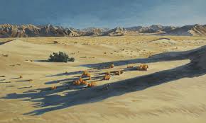
There are about 25 million acres of desert in California
and Southern Nevada. That's a lot of territory filled with all kinds of
things to see and do. Whatever you enjoy, we built these pages to help you
plan your desert adventure. Start here before you hit the road and you are
bound to have a better trip. Our driving tours can lead you to treasured
places and save you miles and miles out on the dusty trails. Other pages
give you the weather, tips for safe travel, and a schedule of events to
help you plan ahead. So follow one of the links and get going. Early
explorers never had it so good!
Death Valley National Park:
Map
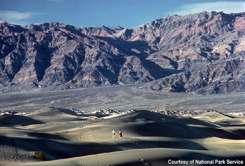
Death Valley National Park has more than 3.3 million
acres of spectacular desert scenery, interesting and rare desert wildlife,
complex geology, undisturbed wilderness, and sites of historical and
cultural interest. Bounded on the west by 11,049 foot Telescope Peak and
on the east by 5,475 foot Dante's View, Badwater is the lowest point (-282
feet) in the North America.
Death Valley has more than 785 miles of roads including hundreds of miles suitable for Mountain Biking.
Hikes are still available in the summer
months, but we recommend the mountains and their spectacular vistas
instead of the canyon grottos.
Death Valley National Park has 9 camp
grounds with about 750 camp sites. Space is limited in some camp
grounds, so reservations will be required. Death Valley National Park's
backcountry has a variety of rugged mountain and desert terrain. More
than 3 million acres of wilderness and over 400 miles of backcountry
dirt roads are open to camping.
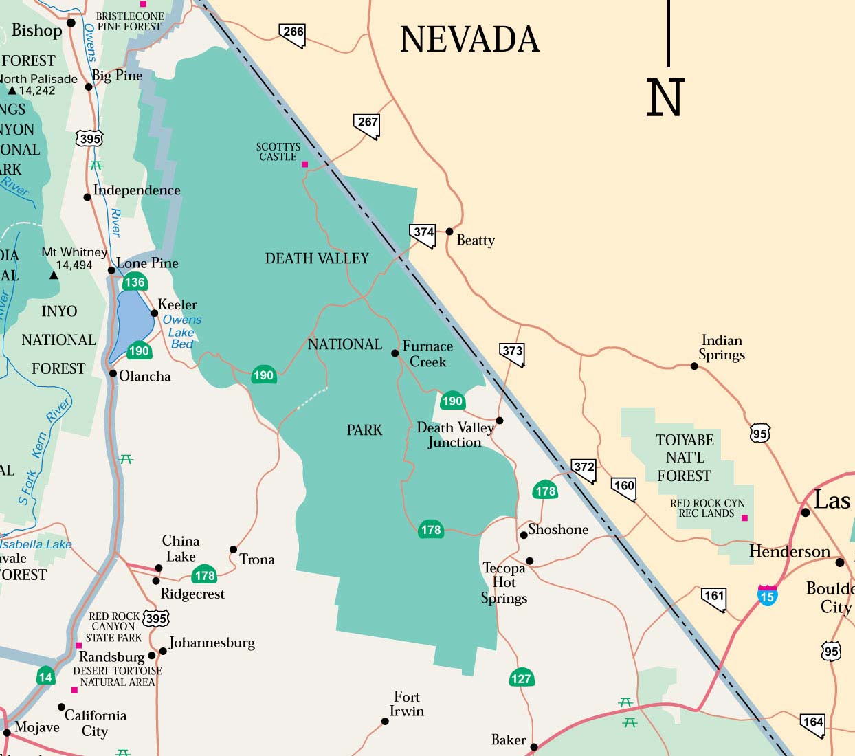 Death Valley National Park is transected from east
to west by California Highway 190. On the east in Nevada, U.S. Route 95
parallels the park from north to south with connecting highways at
Scotty's Junction (State Route 267), Beatty (State Route 374), and
Lathrop Wells (State Route 373). South of the park, Interstate 15 passes
through Baker, California on its way from Los Angeles to
Las
Vegas.
State Route 127 travels north from Baker to Shoshone and Death Valley
Junction with connections to the park on State Route 178 from Shoshone
and connection with California Highway 190 at Death Valley Junction.
Death Valley National Park is transected from east
to west by California Highway 190. On the east in Nevada, U.S. Route 95
parallels the park from north to south with connecting highways at
Scotty's Junction (State Route 267), Beatty (State Route 374), and
Lathrop Wells (State Route 373). South of the park, Interstate 15 passes
through Baker, California on its way from Los Angeles to
Las
Vegas.
State Route 127 travels north from Baker to Shoshone and Death Valley
Junction with connections to the park on State Route 178 from Shoshone
and connection with California Highway 190 at Death Valley Junction.
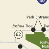
Joshua Tree National Park:
Map
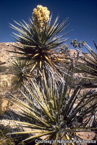
Two deserts, two large ecosystems whose
characteristics are determined primarily by elevation, come together at
Joshua Tree National Park. Below 3,000 feet, the Colorado Desert
encompasses the eastern part of the park and features natural gardens of
creosote bush, ocotillo, and cholla cactus. The higher, moister, and
slightly cooler Mojave Desert is the special habitat of the Joshua tree.
In addition to Joshua tree forests, the western part of the park also
includes some of the most interesting geologic displays found in
California's deserts. Five fan palm oases also dot the park, indicating
those few areas where water occurs naturally and wildlife abounds.
 Joshua Tree National Park lies 140 miles east of Los
Angeles, 175 miles northeast of San Diego, and 215 miles southwest of
Las Vegas. You can approach it from Interstate 10 and Hwy 62 (Twentynine
Palms Highway). The closest airport is in Palm Springs. Public
transportation to the park is not available.
Joshua Tree National Park lies 140 miles east of Los
Angeles, 175 miles northeast of San Diego, and 215 miles southwest of
Las Vegas. You can approach it from Interstate 10 and Hwy 62 (Twentynine
Palms Highway). The closest airport is in Palm Springs. Public
transportation to the park is not available.
There are three park entrance stations:
• The west entrance is located five miles south of the junction of Highway 62 and Park Boulevard at Joshua Tree Village.
• The north entrance is in Twentynine Palms, three miles south of the junction of Highway 62 and Utah Trail.
• The south entrance at Cottonwood Spring, which lies 25 miles east
of Indio, can be approached from the east or west, also via Interstate
10.
• Joshua Tree welcomes climbers and bouldering
enthusiasts from around the world
• Joshua Tree National Park has 9 campgrounds with over 480 campsites available year round.
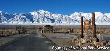
Manzanar National Historic Site:
Map
In 1942, the United States government ordered
more than 110,000 men, women, and children to leave their homes
and detained them in remote, military-style camps. Manzanar War
Relocation Center was one of ten camps where Japanese American
citizens and resident Japanese aliens were interned during World
War II.
Manzanar War Relocation Center was one of ten camps at which
Japanese American citizens and resident Japanese aliens were
interned during World War II. Located at the foot of the imposing
Sierra Nevada in eastern California's Owens Valley, Manzanar has
been identified as the best preserved of these camps.
Manzanar is located at 4,000 feet elevation at the eastern base of
the Sierra
Nevada. Summers are warm and sunny with periods of cool
and windy weather. Winters are cold with moderate snowfall and
brisk sunny days. Comfortable sports wear is appropriate in
summer, but warm clothing should be carried in winter. Strong
winds and blowing dust can occur anytime during the year. Sturdy
walking shoes are advised.
 The Manzanar Pilgrimage, takes place the last Saturday of April
every year and commemorates the closing of the camps. For more
information, contact the Manzanar Committee at
www.manzanarcommittee.org.
The Manzanar Pilgrimage, takes place the last Saturday of April
every year and commemorates the closing of the camps. For more
information, contact the Manzanar Committee at
www.manzanarcommittee.org.
Manzanar is located on the west side of U.S.
Highway 395, 9 miles north of Lone Pine, California and 6 miles
south of Independence, CA.
Directions to Manzanar National Historic Site from Los
Angeles, CA to Manzanar NHS
See ratings  af Desert , Do you have rice or praise for this Bed and Breakfast, Write your review