Visit Central Valley
Central Valley California
Visit Central Valley California
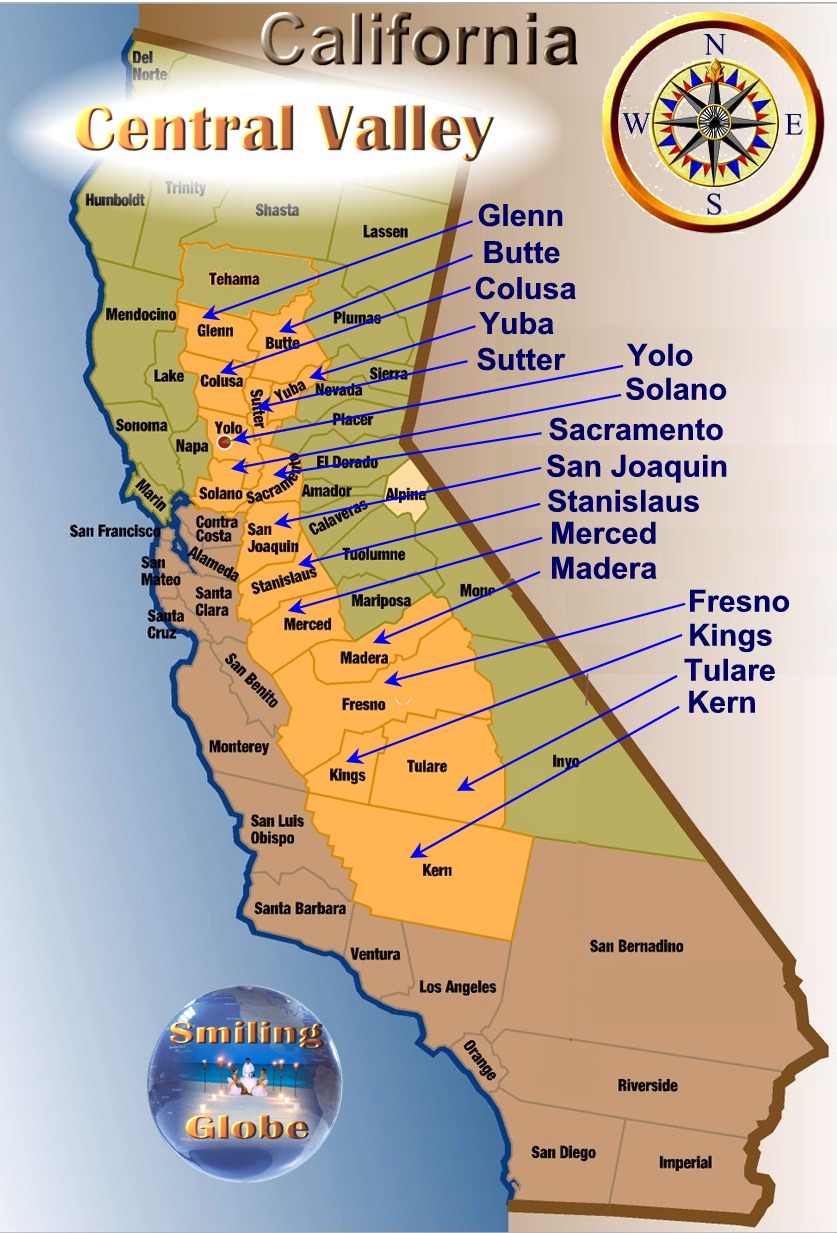
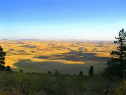
The Central Valley or ( The Valley) is a large, flat valley that dominates the central
portion of California. Central Valley is home to many of
California's most productive agricultural efforts. The valley stretches
approximately 450 miles (720 km) from northwest to southeast inland and
parallel to the Pacific Ocean coast. The valley´s northern half is referred to as
the Sacramento Valley, and the southern half as the San Joaquin Valley.
The Sacramento valley receives about 20 inches of rain annually, but
the San Joaquin is very dry, often semi-arid desert in many places. The
two halves meet at the huge Sacramento-San Joaquin River Delta of the
Sacramento and San Joaquin Rivers, a large expanse of interconnected
canals, streambeds, sloughs, marshes and peat islands. The Central
Valley encompasses around 42,000 square miles (110,000 km2), and making The valley
roughly the same size as the state of Tennessee
| County |
Area |
Population |
Density |
| Glenn
County
|
3,440 km2 |
28,122 |
3,2/km2 |
|
Cities: Willows is the county seat and largest city of
Glenn County California. is Orland
and the population of Orland is estimated at
5,291. (2013)
|
| Butte
County |
33,600 km2 |
220,200 |
33/km² |
Cities: The county seat is Oroville. but the
largest City is Chico.
Chico is the most populous city in Butte County, with a population
of 88,187 (2014)
|
| Colusa
County |
2,990 km2 |
21,419 |
7,2/km² |
Colusa County is located in the U.S. state of California. The population was 21,419 (2010) The county seat is
Colusa. Colusa County is located in the
Central Valley of
California, northwest of the capital, Sacramento.
|
| Yuba
County |
1,670 km2 |
73,955 |
43/km2 |
Cities: Yuba County is located in the state of California. The population was
73,955(2010) The county seat is Marysville
Yuba City is
adjacent to neighboring Yuba County's Marysville, and separated from the latter
by the Feather River. Yuba City is now county seat to
Sutter County
|
| Sacramento Valley |
2,570 km2 |
1,488,788 |
550/km2 |
Sacramento Valley, is a county located in the
southern portion of the state of California.
The population was 1,488,788. (2014) The county seat is Sacramento, and the largest city is Sacramento.
|
| Sutter County |
1,570 km2 |
94,737 |
20/km2 |
|
Sutter County has a population of 94,737. The county is predominantly agricultural, with more than four-fifths (82.5
percent) of its land area in farms (1992 data), and food and kindred products
as its leading industry. Prominent crops include rice and rice seed, prunes,
tomatoes, walnuts, peaches, melons, and nursery products. The county seat is Yuba City
|
| Yolo
County |
2,650 km2 |
207,849 |
76/km2 | |
Geographically, Yolo County falls into the Sacramento Valley, as the county is
to the north and west of Sacramento County. However, the county also has an
association with the San Joaquin Valley by way of the University of California
at Davis, in Yolo County, closely involved with San Joaquin Valley agriculture.
Yolo county is somewhat unique in any event, however, as home to the only UC
campus in the Central Valley. Another Central Valley UC campus is being
planned for Merced County. Yolo County's residents tend to be more affluent
and better educated than most of the Central Valley counties because of the
presence of the University of California campus there. The largest city is Davis.
And the county seat is Woodland
(formerly Yolo City)
|
| Solano
County |
2,570 km2 |
413,344 |
510/km2 | |
Solano County is located in California. The population is 413,344.(2014) The county seat is
Fairfield, and the largest city is Vallejo.
Solano County comprises the Vallejo-Fairfield, CA Metropolitan Statistical Area, which is also included in the San Jose-San Francisco-Oakland, CA Combined Statistical Area.
|
| San Joaquin County |
3,600 km2 |
715,597 |
190/km2 | |
| San Joaquin County California. The population was 715,597.(2014) The county seat is
Stockton
Immediately south of Sacramento County, San Joaquin County is in the heart of
the agricultural Central Valley, with an astonishing 87.5 percent of its land
area in farms (1992 data). What makes this figure surprising is that at the
same time the county has a population of over half a million (529,300, January
1, 1996 estimate). Most of the county's population is in incorporated cities:
Stockton (233,600), Lodi (54,500), Manteca (44,950), Tracy (44,900), Ripon
(9,100), Lathrop (8,850), and Escalon (5,275). The remaining 128,200 are in
unincorporated areas.
San Joaquin County's leading industry is, not surprisingly, food and kindred
products, far outdistancing stone, clay and glass products; lumber and wood
products; fabricated metal products; and several others (based on 1992 data).
Leading agricultural commodities in the county are grapes and milk, followed at
a distance by almonds, tomatoes, walnuts, apples, and others. The county is
increasingly serving as a bedroom community for Bay Area and Silicon Valley
workers as a result of its less costly homes.
|
| Stanislaus County |
3,870 km2 |
514,453 |
130/km2 | The county seat is Modesto |
Immediately south of San Joaquin County, Stanislaus County is also
predominantly farmland (79.4 percent, according to 1992 data), but also has a
substantial population of 513,300. Cities in the county are Modesto
(201,700),
Turlock (49,200), Ceres (31,100), Oakdale (14,300), Riverbank (13,350),
Patterson (9,600), Waterford (6,375), Newman (5,750), and Hughson (3,530). The
remaining 103,400 residents are in unincorporated areas. The leading industry
in the county is food and kindred products, far outdistancing paper and allied
products, fabricated metal products, and others. The county's main
agricultural products include milk, almonds, chickens, chicken eggs, cattle and
calves, turkeys, walnuts, tomatoes, alfalfa, and peaches.
|
| Merced County |
5,130 km2 |
266,353 |
50/km2 | The county seat is Merced |
Another predominantly farmland county (79.2 percent of land in farms), Merced County is immediately south of Stanislaus and, like
Stanislaus, firmly in the center of the Great Central Valley. The county's
population of 266,353 is distributed among several cities: Merced (80,793),
Atwater (20,900), Los Banos (20,100), Livingston (10,450), Dos Palos (4,360),
and Gustine (4,140). The remaining 77,500 residents are in unincorporated
areas. As is so typical in the Central Valley counties, Merced's leading
industry is food and kindred products. Chief products include milk (the clear
leader), almonds, chickens, cotton, tomatoes, alfalfa hay, cattle, sweet
potatoes, turkeys, and eggs. A new University of California campus is being
planned for Merced County.
|
| Madera County |
5,580 km2 |
154,865 |
27/km2 | The county seat is Madera |
Although Madera County falls in the Central Valley, sandwiched in part between
Merced and Fresno, it also reaches east, well into the Sierra National Forest
and Yosemite National Park. The county's 154,865 people are distributed among
the City of Madera (34,650), City of Chowchilla (6,600), and unincorporated
areas (67,600). Leading industries include food and kindred products; stone,
clay, and glass products; and industrial machinery and equipment (based on 1992
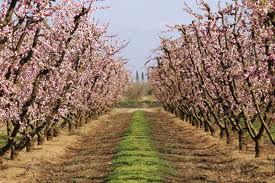
data). Primary agricultural products include grapes (raisin and wine
varieties), almonds, milk, cotton, alfalfa hay, pistachios, cattle and calves,
and apples.
|
| Fresno
County |
15,570 km2 |
965,974 |
40/km2 | The county seat is Fresno |
|
Large both in land area and population, Fresno County, like Madera, stretches
well to the east of the valley and into the Sequoia National Park. About 40
percent of the land in Fresno County, mostly in foothill and mountain areas, is
owned by government, predominantly the federal government. (Madera has a
comparable percentage, and Tulare an even higher one.) The City of Fresno
(400,400) encompasses more than half of the county's 965,974 population. The
rest of the county's residents are distributed among 14 other incorporated
cities (Clovis, at 65,000, by far the largest of them), and unincorporated
areas (174,200).
Leading industries include food and kindred products (far in front); industrial
machinery and equipment; printing and publishing; and stone, clay, and glass
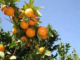
products. Primary agricultural products include cotton, grapes, poultry,
tomatoes, milk, head lettuce, almonds, cattle and calves, nectarines, and
oranges. (Citrus production has tended in recent decades to move from southern
California into the Central Valley, as development in the former has displaced
groves.) Fresno is the most productive agricultural county in the state and in
the nation.
|
| Kings County |
3,610 km2 |
150,269 |
42/km2 | The county seat is Hanford |
Rivaling San Joaquin County in this statistic, Kings County has 87.2 percent of
its land area in farms (1992 data). Kings is tucked between Fresno, Tulare,
and Kern counties, with a small western border along coastal Monterey
County.
The county's leading industry is, of course, food and kindred products. The
dominant agricultural products are cotton/cottonseed and milk, followed
distantly by cattle and calves, turkeys, grapes, peaches, and other products.
Kings County's population of 150,269 is distributed among the cities of Hanford
(55,283), Lemoore (16,350), Corcoran (14,600), Avenal (12,350), and
unincorporated areas (37,050).
|
|
Tulare County |
12,530 km2 |
458,198 |
42/km2 | The county seat is
Visalia |
Tulare County, immediately to the east of Kings, stretches into the Sequoia
National Forest and Inyo National Forest. A majority of the county's land area
(52 percent, mostly in foothill and mountain areas) is owned by government,
predominantly the federal government, the highest percentage among the Central
Valley counties. The county's population of 458,198 resides in the cities of
Visalia (124,442), Tulare (49,750), Porterville (34,550), Dinuba (14,650),
Lindsay (8,825), Exeter (8,275), Farmersville (7,125), and Woodlake (6,125),
with the other 140,800 in unincorporated areas. The leading industry is food
and kindred products, followed distantly by printing and publishing, lumber and
wood products, fabricated metal products, and electronic and other electric
equipment (1992 data). Agricultural products include milk, oranges, grapes,
cattle and calves, cotton lint and seed, and others. Tulare County is one of
the most productive agricultural counties in California, in terms of value of
production, second only to Fresno.
|
|
Kern County |
21,140 km2 |
874,589 |
40/km2 | The county seat is Bakersfield |
|
At the south end of the Central Valley, Kern County is immediately north of
Ventura and Los Angeles
counties, and south of Kings and Tulare. Mountain
ranges, including the Tehachapi Mountains, mark the southern end of the Central
Valley, south and east of Bakersfield. The county's population of 624,700
resides in the City of Bakersfield (312,700) and ten much smaller cities
(Delano being the largest, with 31,450 residents), with 280,500 in
unincorporated areas.
Again, food and kindred products constitute the county's leading industry,
followed by chemicals and allied products; rubber and miscellaneous plastics
products; and printing and publishing. The county's large and varied
agriculture (fourth among California counties) includes grapes,
cotton/cottonseed, citrus, almonds, milk, cattle and calves, and others. More
than half of the county's land area (54.5 percent) is in farms (1992 data).
The county is also known for its oil fields.
|
 |
| Central Valley agriculture |
California´s great Central Valley stretches from Shasta County to Kern
County--some 450 miles long and typically 40 to 60 miles wide. It encompasses
18 counties with a total of over five million people and over 42,000 square
miles--one-sixth of the population and more than two-fifths of the land area of
the state.
Not all of the Central Valley is encompassed in these counties. The list omits
Solano County (which is south of Yolo and west of Sacramento), although much of
Solano's land area falls within the valley geographically. Because Solano
touches on the San Francisco
Bay, the county is included in the Bay Area, not
the Central Valley, for planning and statistical purposes.
Portions of some of the 18 counties fall outside the valley. Some counties
reach into the Sierra foothills and beyond, and much of Shasta County is north
of the valley. Placer County reaches well into the Sierra, although the
county's population is predominantly in the valley and facing issues of growth,
development, and conservation typical of Central Valley communities. All in
all, these 18 counties are clearly separate from the urban centers of San
Francisco, Los Angeles, Riverside-San Bernardino, and San Diego and from the
coastal, mountain, and desert regions of the state.
 |
| Central Valley |
To many urban Californians, the Central Valley is "flyover country," the area
one flies over or drives through to reach places of greater interest, or simply
a source of agricultural goods as diverse as cotton, tomatoes, and rice--nearly
$14 billion worth of production value in 1995--to the extent they think about
it at all. To increasing numbers, however, at least parts of the Valley are
home, as San Francisco Bay Area workers discover the less costly real
estate of Modesto, Ripon, Stockton, and Vacaville.
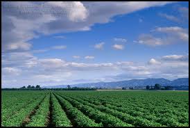
The Central Valley is indeed centered on agriculture. Eight of California's 15
top producing agricultural counties are in the Central Valley, and of the top
seven, only one (Monterey) is not encompassed in the area from San Joaquin to
Kern. This area is not only the most productive in California, it is widely
considered the most productive in the world. This productivity has not
come easily, as it has required the combined efforts of laborers, land-owners,
agricultural researchers, hydraulic engineers, and many others over
generations. It also reflects a range of growing conditions (soils and local
climates) conducive to specific crops.
 |
| Central Valley agriculture |
Much of the economic activity of the Central Valley that is not directly
agricultural is at least associated with agriculture: packing, shipping,
processing, and the myriad specialties needed to support agricultural
enterprises, from irrigation systems to pesticide research. Some observers
attribute as much as 30 percent of the Central Valley's total economy to
agriculture, considering indirect "multiplier" effects. Rapid and accelerating
population growth in the Valley, however, does not simply reflect burgeoning
agriculture, nor can long-term prosperity rest exclusively on the products of
the land.
The Central Valley is a large and diverse area
Although the term "the Central Valley" refers to an area stretching from Shasta
to Kern, that area does not constitute a single community in any sense of the
term. The length of the valley, about 450 miles, is about the distance from
Chicago, Illinois, to Pittsburgh, Pennsylvania, localities with distinct local
identities, media outlets, and labor pools. It would take about 8 hours to
drive from Redding, at the north end of the valley, to Bakersfield, at the
south end, which suggests that direct interaction across the length of the
valley is essentially nonexistent. Even Fresno, in the heart of the valley, is
a three to four hour drive from Sacramento and two hours or more from
Bakersfield.
 |
| Central Valley agriculture |
No print or broadcast media serve the entire valley, or even a preponderance of
it. Separate media markets exist for many communities within the Central
Valley, including Bakersfield,
Fresno, Merced, Modesto, Stockton,
Sacramento,
Chico, Red
Bluff, and Redding. Stockton and
Sacramento do share a television
market, but have different local newspapers and radio stations. Other cities
and towns throughout the valley also have local newspapers and radio
stations.
Although agriculture is widespread throughout the valley, crops vary, and there
is not even a unified "agricultural community" encompassing the entire area.
Instead, there are many agricultural interests with different concerns and
whose common concerns (water and environmental issues, for example) are not
unique to the valley.
Geographically, the Central Valley may be subdivided into northern and southern
portions. The northern part, the
Sacramento Valley, encompasses 10 counties,
and the southern, or San Joaquin Valley, encompasses eight. Even these two
sub-regions are large and internally diverse.
The entire area, as a valley, constitutes a single vast air basin, although
specific issues do vary with local terrain, climate, agriculture, population,
and industry. For planning purposes, the Central Valley is divided into the
Sacramento Valley Air Basin and the San Joaquin Valley Air Basin. Those
basins generally correspond to the groups of counties used in this paper.
In terms of watersheds, the Central Valley is encompassed by the Sacramento
River watershed, the San Joaquin River watershed, and the Tulare Lake
watershed. The Sacramento River watershed stretches from roughly the
northeast corner of California to Sacramento County. The San Joaquin Valley
watershed encompasses the area from Sacramento County (including the southeast
corner of the county itself) to Madera County (and portions of
Fresno County).
The Tulare Lake watershed includes most of Fresno County, all of Kings and
Tulare counties, and all but the eastern fifth or so of Kern County.
 |
| agriculture butte county |
Butte
In terms of population, Butte County is the largest in the Central Valley north
of the Sacramento metropolitan area (although Shasta is only about 30,000
behind). The county's population of 220,000 encompasses several cities.
Chico, at 47,200 is the largest, followed by Paradise (25,900), Oroville
(12,400), Gridley (4,780), and Biggs (1,640). The majority of the county's
population (105,000), however, is in unincorporated areas. The county hosts a
campus of California State University at Chico. Leading industries include
food and kindred products, lumber and wood products, and printing and
publishing. More than two-fifths (43.1%) of the county's land area was in
farms as of 1992, with rice and almonds being the leading products, followed by
walnuts, prunes, and several other products. The county seat is
Oroville but the largest City is Chico. Butte County is known as the "Land of Natural Wealth and Beauty."
In terms of population, Butte County is the largest in the Central Valley north
of the Sacramento metropolitan area
Many Butte County residents live in one of the five incorporated towns or cities: Biggs, Chico, Gridley, Oroville or Paradise, but Butte County is a place of natural beauty with countless opportunities for recreation in both rural and urban environments.
Oroville is situated at the base of the foothills on the banks of the Feather River where it flows out of the Sierra Nevada onto the flat floor of the Sacramento Valley. It was established as the head of navigation on the Feather River to supply gold miners during the California Gold Rush.
The Oroville Dam, perhaps Oroville's most famous site, is one of the 20 largest dams in the world
 |
| agriculture Colusa county |
Colusa
One of California's least populous counties, Colusa County is south of Glenn
County and west
of Sutter County. The county's population of 21,419 is distributed among the cities
of Colusa (5,971), Williams (3,020) and unincorporated areas (9,650). Some
61.1 percent of the county's land area is in farms (1992 data), producing rice,
tomatoes, and almonds, followed by wheat, rice seed, and several other
products. The western portion of the county is in the Mendocino National
Forest. Colusa's population growth rate has been modest since 1940 by
comparison with most of the Central Valley, but was more typical during the
period 1980-95.
Sutter
B-52 airplane crash
On March 14, 1961, a B-52 Stratton fortress carrying nuclear weapons, flying near Yuba City encountered a pressurization problem, and had to drop to a lower altitude. As such, more fuel than expected was used, and the aircraft ran out of fuel. It crashed before meeting with a tanker aircraft. The pilot gave the bailout command, and the crew
aggressed at 10,000 ft, except for the pilot, who ejected at 4,000 ft, while avoiding a populated area. The aircraft was destroyed. The weapons, two Mark 39 (3.8 megatons each) thermonuclear bombs (identified from declassified Department of Energy films and photographs) were destroyed on impact though no explosion took place, and there was no release of radioactive material as a result.
Yuba
North of Placer County and east of Sutter County, Yuba County has a population
of 62,200. The county has two cities, Marysville (population 12,550,
constrained by the Feather and Yuba rivers) and Wheatland (1,960), with the
large majority of the population (47,700) in unincorporated areas, including
Olive Hurst and Linda. Yuba County is predominantly agricultural, with nearly
three-fifths (58.2 percent) of its land area in farms (1992 data). Leading
industries include lumber and wood products as well as food and kindred
products. Crops include rice, prunes, walnuts, peaches, cattle and calves,
milk, and kiwifruit.
Placer
Geographically, most of Placer County is in the Sierra Nevada mountain range,
not in the valley. Most of Placer's population of 206,000, however, is
centered in and near Roseville (59,700), north of Sacramento County and of
course within the Central Valley. Other cities in the county include Rocklin
(26,900), Auburn (11,450), Lincoln (7,950), Loomis (6,025), and Colfax (1,450).
The county's population is growing rapidly and its economic base is developing,
with emphasis on electronics and other electrical equipment, now the county's
leading industry, followed by lumber and wood products. Although about 15
percent of the county's land area is in farms (1992 data), agriculture is of
relatively minor importance to the county's economy now.
Sacramento
Sacramento valley / County is unusual in that it is the State Capital, and therefore
home to the Legislature, Governor's Office, and a host of departments and
agencies. Nearly one-quarter of
Sacramento County's employed residents are employed
by state and local government (1994 data). The county is also distinctive
among Central Valley counties by virtue of its population, which at 1,123,400
makes it the largest in the valley, and its density of population, which at
more than 1,200 per square mile far exceeds any other in the valley.
Leading industries in the county include food
and kindred products, printing and publishing, electronic and other electric
equipment, and fabricated metal products. Despite the county's density of
population, a striking 61.3 percent of its land area is in farms (1992 data),
producing milk, wine grapes, Bartlett pears, field corn, tomatoes, turkeys, and
other products.
The South, or San Joaquin Valley
As above, here are individual county profiles, generally in north to south
order.
The City of Bakersfield is about as far from Los Angeles as it is from Fresno,
although the trip to Los Angeles goes through mountain ranges and that to
Fresno is over flat valley land.
See ratings  af Central Valley , Do you have rice or praise for this Bed and Breakfast, Write your review